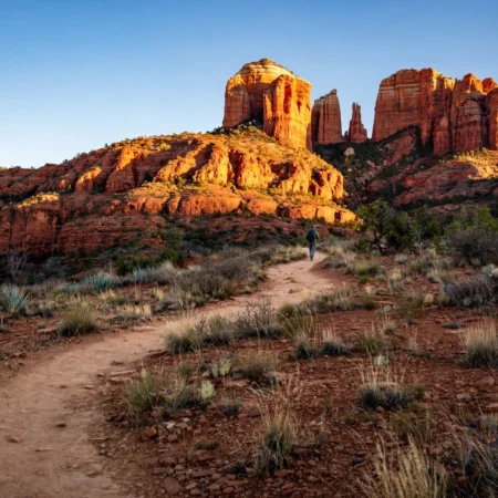
Travel to Sedona: The Complete 2026 Guide to Red Rocks, Hikes, Vortex Sites and Stargazing
Quick Answer: Should You Travel to Sedona?
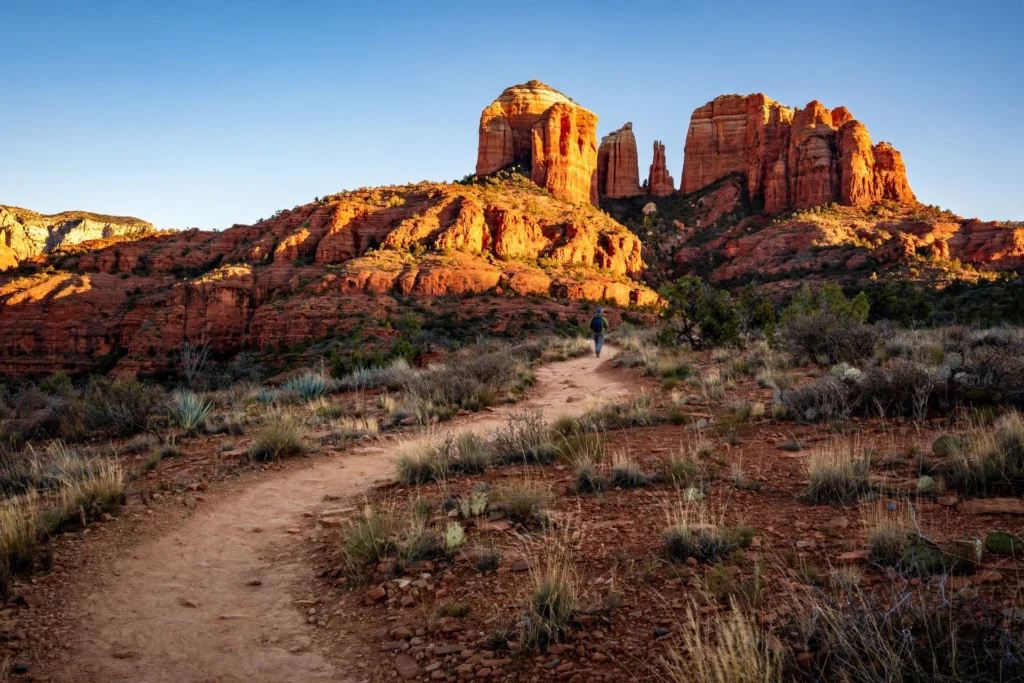
Yes — travel to Sedona if you want a desert trip that is easy to reach, easy to plan, and hard to forget. Sedona, Arizona, is a small town wrapped in red rock formations, about a two-hour drive north of Phoenix and about 45 minutes south of Flagstaff. It has more than 300 miles of trails, viewpoints you can reach without hiking at all, a natural waterslide in Oak Creek Canyon, and some of the darkest night skies in the United States. It works as a long weekend, a three-day trip, or a base for a longer Arizona road trip that takes in the Grand Canyon.
The honest version is that Sedona is popular, and the popular places are busy. The two most famous hikes — Cathedral Rock and Devil’s Bridge — have small parking lots, and on Thursday through Sunday the free Sedona Shuttle replaces driving to those trailheads entirely. Slide Rock State Park, the natural waterslide, admits vehicles only and closes its gate when the lot is full, often by mid-morning on summer weekends. None of that should put you off. It just means the trip rewards a little planning, and this guide is built to give you that planning up front: the fees, the shuttle, the seasons, the hikes, and a three-day itinerary that puts the busy places at the quietest times of day.
This guide covers the whole trip. You will find the logistics box first — passes, shuttle days, and the Slide Rock vehicle-entry rule — so you do not get turned away at a trailhead. Then the best time to travel to Sedona, month by month, the places first-timers should not miss, the best hikes by difficulty, the vortex sites explained as people actually experience them, a family plan, a romantic plan, a stargazing plan, and where to base yourself. Every fee in this guide was checked against the managing agency’s own pages or the sources that cite them in November 2026, and the guide tells you where to re-check before you go, because fees and schedules do change.
Before You Go: The Sedona Logistics Box
Sedona is not a national park, and there is no single entrance fee. Instead, three different systems charge for three different things, and mixing them up is the most common first-timer mistake. A Red Rock Pass does not get you into Slide Rock State Park. A federal America the Beautiful pass does not get you into a state park either. And on shuttle days, no pass at all gets your car into the Cathedral Rock or Soldier Pass trailhead lots, because those lots are closed to private vehicles while the shuttle runs. Read this section once, and the rest of the trip runs smoothly.
The Red Rock Pass, explained
Most of Sedona’s trailheads sit on Coconino National Forest land. If you park at one of the designated Forest Service day-use sites and leave your vehicle to hike, picnic, or take photographs, you need a Red Rock Pass or an accepted federal pass. The pass is a parking permit, not a hiking permit — nobody charges you to walk on a trail. The current prices, confirmed against the Coconino National Forest pass programme and its authorised vendor in October and November 2026, are $5 for a day, $15 for a week, and $20 for a year, per vehicle, covering everyone who arrived in that vehicle. An America the Beautiful pass ($80 a year) works at the same sites, so if you already own one, or you plan to visit any national park in the same year, you do not need a Red Rock Pass as well.
A few details that save money and confusion. A stop of about 15 minutes or less — pulling in for a photograph and driving on — does not need a pass. You can buy the pass at a trailhead kiosk (card payment) or in advance through Recreation.gov, where the online pass is tied to your licence plate, so type the plate carefully. The Forest Service fee-site table lists 22 designated sites in the Red Rock Ranger District, including Cathedral Rock, Bell Rock, Boynton Canyon, and Devil’s Bridge trailheads. If you ride the free Sedona Shuttle instead of driving, you need no pass at all for that hike.
The free Sedona Shuttle
The Sedona Shuttle is the town’s free trailhead bus, and it is the single most useful thing to know about before you travel to Sedona. It runs Thursday through Sunday, year-round, from 7:00 a.m. to 5:30 p.m., with daily service during spring break (late February to late April) and selected holiday periods. It serves five trailheads on three routes, all free, with no reservation and no pass required:
- Route 11 — from the West SR-89A Park & Ride (905 Upper Red Rock Loop Road) to Dry Creek Vista and Mescal, the usual access for Devil’s Bridge.
- Route 14 — from Posse Grounds Park & Ride (20 Carruth Drive, West Sedona) to Soldier Pass.
- Route 15 — from the North SR-179 Park & Ride (1294 SR 179) to Cathedral Rock and Little Horse.
The rule that catches people out is the lot closure. On every day the shuttle operates, the Cathedral Rock and Soldier Pass trailhead lots are closed to private vehicles — the gates are locked, and it is not a matter of the lot filling up. You park at the park-and-ride lot and ride the shuttle, which adds roughly 30 to 60 minutes to the morning. On Monday through Wednesday, when the shuttle does not run, those lots are open to cars again. The shuttle’s published calendar also adds daily service in busy windows — including November 19–29, 2026 (except Thanksgiving Day, November 26, when there is no service), December 17–24, and December 26, 2026 through January 3, 2027 — and there is no service on Christmas Day. Check the current timetable on the shuttle’s own site the evening before your hike, because operating days change with the season. A separate city service, Sedona Shuttle Connect, is an on-demand van around town for $2 a ride.
Slide Rock State Park and the other separate fees
Slide Rock State Park is an Arizona State Park, a completely separate system from the Forest Service. Neither a Red Rock Pass nor an America the Beautiful pass works there. Entry is $30 per vehicle (one to four people) from May through September, and $20 per vehicle from October through April, with $5 for each additional adult and children under six free. Entry is by vehicle only through the entry station — no walk-ins, no drop-offs, and no bicycles are admitted — and the lot closes when it is full, which happens often by 9 a.m. on summer weekends. Card payment is strongly preferred, and cash users need exact change.
Two more fees to know about. West Fork, the shady creekside trail in Oak Creek Canyon, and Crescent Moon Ranch are concessionaire sites, not covered by the Red Rock Pass; they charge their own day-use fee (typically $15 per vehicle) or accept the Coconino Hospitality Annual Pass ($50 a year). Red Rock State Park, a different park from Slide Rock, charges its own admission (about $10 per adult). Note also that flooding on November 1, 2026 damaged Oak Creek Canyon: Slide Rock State Park closed and was scheduled to reopen on November 7, 2026, while Red Rock State Park was still closed with no reopening date as of that week, and State Route 89A north of the park toward Flagstaff stayed closed — so arrive from the Sedona side and check the park’s own page and road conditions before you go.
Fees and passes at a glance
| Fee or pass | Cost (checked Nov 2026) | Where it works | Where it does NOT work |
|---|---|---|---|
| Red Rock Pass, daily | $5 per vehicle | Designated Coconino National Forest trailheads and picnic sites | State parks, concessionaire sites |
| Red Rock Pass, weekly | $15 per vehicle | Same designated Forest Service sites, 7 days | State parks, concessionaire sites |
| Red Rock Pass, annual | $20 per vehicle | Same designated Forest Service sites, 12 months | State parks, concessionaire sites |
| America the Beautiful pass | $80 per year | Same Forest Service sites, plus national parks nationwide | State parks, concessionaire sites |
| Slide Rock State Park | $30 per vehicle May–Sep; $20 Oct–Apr | Slide Rock State Park only, 1–4 people | Everywhere else |
| West Fork / Crescent Moon Ranch | About $15 per vehicle day-use | Those concessionaire sites only | Forest Service trailheads |
| Coconino Hospitality Annual Pass | $50 per year | The five concessionaire sites | Forest Service trailheads, state parks |
| Sedona Shuttle | Free | Five trailheads, Thu–Sun 7:00 a.m.–5:30 p.m. | — |
| Red Rock State Park | About $10 per adult | Red Rock State Park only | Slide Rock, Forest Service sites |
All figures are the agencies’ published prices as checked in November 2026. Confirm them on the official pages linked in this guide before you travel, because fees change with little notice.
The three mistakes first-timers make
First, driving to Cathedral Rock on a Saturday morning and expecting to park at the trailhead. You cannot. Take Route 15 from the North SR-179 Park & Ride, or go on a Monday, Tuesday, or Wednesday. Second, arriving at Slide Rock at noon on a July Saturday and expecting to get in. The lot is usually full by then, and there is no waiting list — you are turned away at the gate. Go at opening time, 8 a.m. in the summer season, or visit on a weekday. Third, assuming one pass covers everything. Budget separately for the Red Rock Pass, Slide Rock, and any concessionaire site, and the trip has no expensive surprises.
Where Is Sedona and How Do You Get There?
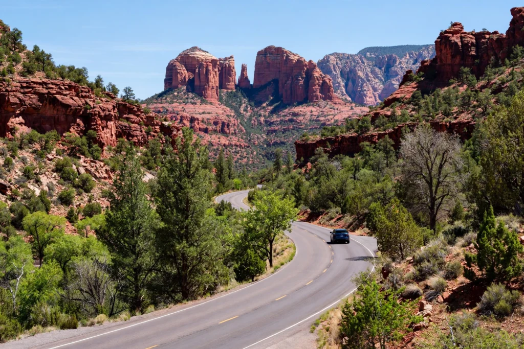
Sedona sits in northern Arizona, in the high desert where the Colorado Plateau begins to break into red rock canyons. The town is about 115 miles north of Phoenix — roughly a two-hour drive on Interstate 17 and then State Route 179 — and about 30 miles south of Flagstaff, roughly 45 minutes on State Route 89A through Oak Creek Canyon. That canyon drive is one of the prettiest approaches in the American Southwest, a winding road between red cliffs and a creek lined with sycamores and oaks, and it is worth doing in daylight at least once.
Most visitors fly into Phoenix Sky Harbor International Airport, rent a car, and drive north. Flagstaff Pulliam Airport is closer and smaller, with fewer flights, and works well if you are combining Sedona with the Grand Canyon. There is no train to Sedona and no practical way to do the trip without a car unless you stay in town and use the shuttle and the on-demand van — and even then, Oak Creek Canyon and the Verde Valley are out of reach. A rental car is the right call for almost every visitor, and a standard car is fine: every road in this guide is paved, and the only unpaved driving is the rough dirt road to the Devil’s Bridge trailhead, which the shuttle and the Mescal trailhead let you skip entirely.
The town, in four parts
Sedona is not one centre but a spread-out town, and knowing the four parts saves a lot of driving. Uptown Sedona is the walkable strip of shops, galleries, and restaurants at the junction of Routes 179 and 89A, and it is the busiest place in town — charming, but crowded, and parking is tight. West Sedona is the practical side: grocery stores, the Posse Grounds Park & Ride, most of the mid-range hotels, and the road out to Dry Creek and Boynton Canyon. The Village of Oak Creek, about seven miles south on Route 179, is quieter, closer to Bell Rock and Cathedral Rock, and home to the North SR-179 Park & Ride. Oak Creek Canyon, north on Route 89A, is where Slide Rock State Park and West Fork sit, and where the road climbs toward Flagstaff. If you want to walk to dinner, stay in Uptown. If you want a quiet base with easy trailhead access, stay in West Sedona or the Village of Oak Creek.
Getting around without a car, honestly
It is possible to visit Sedona without a car, but only with limits. The free Sedona Shuttle covers five trailheads Thursday through Sunday, and Sedona Shuttle Connect, the city’s $2 on-demand van, covers most of town from about 6:30 a.m. to 8:30 p.m. on shuttle days. Between those two, you can hike Cathedral Rock, Devil’s Bridge, and Soldier Pass, eat in Uptown, and watch the sunset from Airport Mesa. What you cannot do without a car is Oak Creek Canyon, the Verde Valley wineries, Montezuma Castle, or a Grand Canyon day trip. If you are flying in and staying three days, rent the car. If you are staying a week and want a car-free weekend in town, the shuttle and the van are genuinely workable — plan around Thursday to Sunday, when both run.
How long do you need?
Two days is enough to see the famous places: one day for Cathedral Rock and the viewpoints, one day for Devil’s Bridge and Slide Rock or Oak Creek Canyon. Three days is the sweet spot, and it is the length of the itinerary in this guide — it adds a slower day for the vortex sites, the galleries, and a proper sunset, plus a buffer for the one thing Sedona guarantees, which is that you will want to linger somewhere. Four or five days lets you add a Grand Canyon day trip, a Verde Valley wine afternoon, and a rest day by a hotel pool. Less than two days is a drive-through, and Sedona deserves better than that.
The Best Time to Travel to Sedona: Seasons and Month by Month
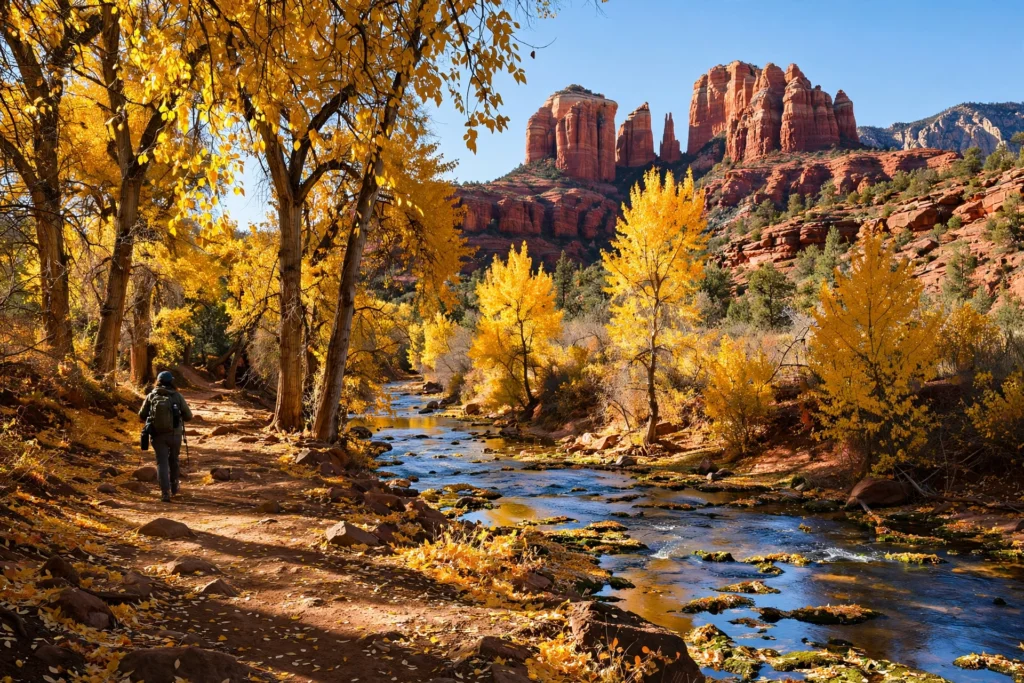
The best time to travel to Sedona is spring and autumn — specifically April and October at the top of the list, with March, May, September, and November close behind. Those months give you the combination that makes Sedona work: daytime temperatures comfortable for hiking, cool mornings and evenings, clear skies, and the red rock at its most vivid in low, warm light. Summer is hot and busy, winter is quiet and crisp, and each season suits a different kind of trip. The table below is built from typical climate averages for planning, not a forecast — check the National Weather Service Flagstaff office before you pack.
Spring: March to May
Spring is Sedona’s prime season, and April is the single best month for most people. Daytime highs run from the low 70s Fahrenheit in March into the mid-80s by May, mornings are cool enough for a jacket, and the desert is at its greenest after winter rain. Wildflowers appear in March and April, the creek runs well, and the light is long and golden. The trade-off is crowds: spring break runs from late February to late April, the shuttle goes daily, and the popular trailheads are at their busiest. Book lodging early for March and April, start hikes before 8 a.m., and use the shuttle rather than fighting for parking.
Summer: June to August
Summer in Sedona is hot, bright, and crowded in a different way. Daytime highs typically reach the mid-90s Fahrenheit, and the sun is strong at 4,500 feet of elevation. The trick is to hike early — on the trail by 7 a.m., finished by 11 a.m. — and spend the middle of the day in the shade, in the water at Slide Rock, or in a gallery in Uptown. Afternoon thunderstorms roll in during the monsoon season, roughly July through mid-September, and they are spectacular and dangerous in equal measure: lightning on exposed ridges and flash floods in narrow canyons are real risks, so check the forecast and get off high ground when storms build. Summer is also the best time for Slide Rock, because the creek water is at its warmest, and for stargazing, because the nights are warm enough to lie out comfortably. Families with school-age children will find summer the easiest time to come — just plan around the heat.
Autumn: September to November
Autumn is the other prime season, and October rivals April as the best month of the year. September is still warm, with highs in the high 80s, and the monsoon fades by mid-month. October brings highs in the high 70s, cool evenings, and the cottonwoods and sycamores in Oak Creek Canyon turning gold — the best fall colour in Arizona, and a reason to hike West Fork in October above all other months. November is cooler, quieter, and cheaper, with highs in the mid-60s, and it is a good month for travellers who would rather have the trails to themselves than have warm weather. The shuttle’s extra daily service in late November covers the Thanksgiving week, and there is no service on Thanksgiving Day itself.
Winter: December to February
Winter is Sedona’s quiet season, and it suits travellers who like space more than warmth. Daytime highs are typically in the high 50s to low 60s Fahrenheit, nights drop near or below freezing, and snow falls occasionally — usually a light dusting on the red rocks that melts by midday, which is one of the prettiest sights in the Southwest. Trails are empty, lodging is at its cheapest, and the shuttle runs its normal Thursday-to-Sunday pattern with extra daily service around Christmas and New Year, except Christmas Day, when there is no service. Winter is also a good time for the indoor side of Sedona: galleries, spas, and long lunches. If you travel to Sedona in winter, pack layers and a warm jacket, and check road conditions on Route 89A after any storm. For a wider look at travelling in the coldest month, the Christmas travel guide on this site covers winter trips in general, including what is actually open on Christmas Day.
Month by month
| Month | Typical daytime high | What it is like | Best for | Watch out for |
|---|---|---|---|---|
| January | High 50s °F | Crisp, quiet, occasional snow dusting | Empty trails, low prices, photography | Freezing nights, short days |
| February | Low 60s °F | Cool and bright, still quiet | Hiking without crowds, early spring break | Cold mornings, shuttle Thu–Sun only |
| March | Low 70s °F | Warming up, wildflowers starting | Hiking, first warm-weather trips | Spring break crowds build |
| April | High 70s °F | The best all-round month | Everything — hiking, viewpoints, photography | Busiest month, book ahead |
| May | Mid-80s °F | Warm and dry, long days | Slide Rock opens for the season, long hikes | Heat by late May, crowds |
| June | Mid-90s °F | Hot and dry | Early-morning hikes, Slide Rock | Midday heat, start by 7 a.m. |
| July | Mid-90s °F | Hot, monsoon storms begin | Slide Rock, warm-night stargazing | Lightning, flash floods |
| August | Low 90s °F | Hot, monsoon continues | Water, shade, evening light | Storms, humidity, crowds at Slide Rock |
| September | High 80s °F | Cooling, monsoon fades | Hiking returns, fewer crowds | Early-month storms |
| October | High 70s °F | Golden, the other best month | Fall colour in Oak Creek Canyon, hiking | Popular weekends, book ahead |
| November | Mid-60s °F | Cool, quiet, golden light | Quiet trails, lower prices | Short days, Thanksgiving week |
| December | High 50s °F | Crisp, festive, occasional snow | Spas, galleries, Christmas trips | Christmas Day — no shuttle service |
Temperatures are typical averages for planning, rounded, and not a forecast. Sedona sits at about 4,300 to 4,500 feet above sea level, so the sun is stronger than the temperature suggests — wear sunscreen and carry more water than you think you need, in every season.
Sedona for First-Timers: The Places You Should Not Miss
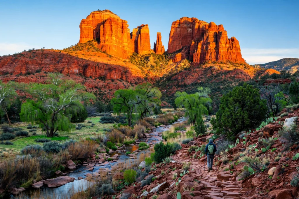
If you have one day in Sedona, spend it on the places in this section. They are the reason people travel to Sedona in the first place: the formations that look carved, the viewpoints that need no hiking at all, and the chapel built into the rock. The table below gives you the practical shape of each one — what it is, how long it takes, what it costs, and when to go — and the text that follows fills in the detail.
| Place | What it is | Time needed | Fee or pass | Best time of day |
|---|---|---|---|---|
| Cathedral Rock | Sedona’s most photographed formation | 1.5–2.5 hours hiking | Red Rock Pass or shuttle | Sunrise or late afternoon |
| Devil’s Bridge | Natural sandstone arch you can walk across | 2–4 hours hiking | Red Rock Pass or shuttle | Early morning |
| Bell Rock | Bell-shaped formation, easy trails at its base | 1–2 hours | Red Rock Pass | Sunset |
| Chapel of the Holy Cross | Chapel built into red rock | 30–60 minutes | Free | Late afternoon |
| Airport Mesa | Viewpoint and sunset spot above town | 30–60 minutes | Free to view; Red Rock Pass to park | Sunset |
| Slide Rock State Park | Natural waterslide in Oak Creek Canyon | 2–3 hours | $20–$30 per vehicle | Morning, before the lot fills |
| West Fork Trail | Shady creekside canyon hike | 3–4 hours | About $15 per vehicle | Morning, October for fall colour |
| Boynton Canyon | Red rock box canyon, vortex site | 2–3 hours | Red Rock Pass | Morning |
| Tlaquepaque Arts & Shopping Village | Spanish-style arts village | 1–2 hours | Free to wander | Late afternoon |
| Oak Creek Canyon drive | Scenic drive, Route 89A | 30–60 minutes | Free | Daylight |
Cathedral Rock
Cathedral Rock is the formation on the postcards: a cluster of red spires rising above Oak Creek, and the view that defines Sedona for most first-time visitors. The hike is short — about 1.2 miles round trip — but it is steep and scrambly near the top, with a section where you climb on all fours over smooth rock. It is not a casual stroll, and it is not the hike for anyone uneasy with heights. The reward is a saddle between the spires with a view down the canyon, and the feeling of standing inside the formation rather than looking at it. Go at sunrise for the quietest experience and the best light, or late in the afternoon when the rock glows. Remember the shuttle rule: on Thursday through Sunday, the trailhead lot is closed to cars and Route 15 from the North SR-179 Park & Ride is the way in.
Devil’s Bridge
Devil’s Bridge is the largest natural sandstone arch in the Sedona area, and the one you can walk out onto — a flat span of rock with a drop on either side, and a photograph that everyone who visits Sedona seems to take. The usual route is from the Mescal trailhead, about 3.8 miles round trip, or from Dry Creek Vista, which makes it closer to 5.8 miles. The climb itself is modest — about 370 feet of elevation gain — but the last section is a steep scramble up rock steps, and there is often a queue at the top to walk out onto the arch. Start early, take the Route 11 shuttle from the West SR-89A Park & Ride on shuttle days, and carry water: there is no shade and no water on the trail. The arch is wider than it looks in photographs, but keep children close and stay behind the informal queue line.
Bell Rock and Courthouse Butte
Bell Rock is the bell-shaped formation you see from Route 179 as you drive in from the south, and it is the best first hike in Sedona. The Bell Rock Pathway is a wide, mostly flat trail that runs along the base of the formation, and you can walk as far as you like and turn back — twenty minutes or two hours, it works either way. Families with small children, anyone with limited mobility, and anyone arriving tired from a flight should start here. The Courthouse Butte Loop continues around the neighbouring formation for a longer, still gentle walk of about four miles. Sunset at Bell Rock is one of the best free shows in town: the rock turns deep red, then purple, and the whole valley seems to change colour.
Airport Mesa
Airport Mesa is the flat-topped mesa above town, next to the small airport, and it is the easiest sunset in Sedona. Drive up, park, and walk a few minutes to the viewpoint, and you have a 360-degree view of the town, the valley, and the ring of red formations around it. It is also one of the four places people come to for the vortex experience, which the later section of this guide explains. The mesa gets busy at sunset — arrive 45 minutes early for a good spot — and the parking lot is a designated fee site, so have a Red Rock Pass or an America the Beautiful pass displayed. The short Airport Loop trail around the mesa is an easy, mostly flat walk if you want to stretch your legs before sunset.
The scenic drive
If you do nothing else, drive Route 179 from the Village of Oak Creek into town, and Route 89A through Oak Creek Canyon. Route 179 is designated a scenic byway, and it earns the title: Bell Rock, Courthouse Butte, and Cathedral Rock appear one after another, with signed viewpoints and pullouts. The pullouts are designated fee sites, so a Red Rock Pass covers a stop of more than 15 minutes. Route 89A north through the canyon is narrower and slower, with the creek on one side and cliffs on the other, and it is the road to Slide Rock State Park and West Fork. Both drives are best in the late afternoon, when the low sun lights up the red rock from the side.
The Best Hikes in Sedona: From Easy Walks to Devil’s Bridge
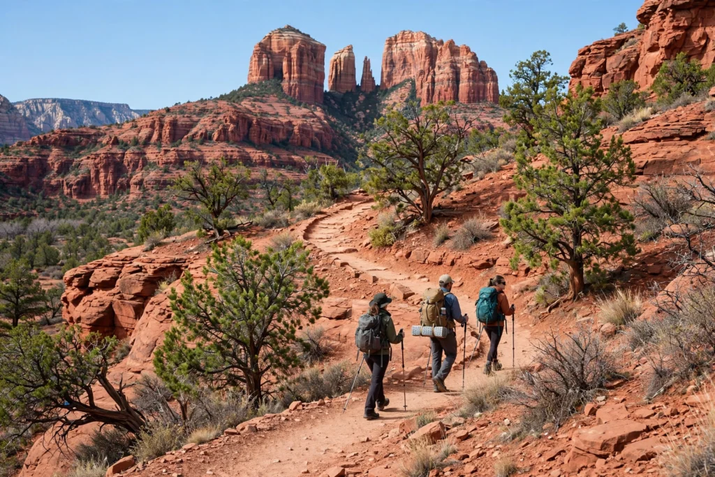
Sedona has more than 300 miles of trails, and the honest truth is that you cannot hike them all in one trip — you do not need to. The trails below are the ones that give the best return for the effort, sorted from easiest to hardest, so you can pick by energy rather than by reputation. Distances and elevation figures are the published trail figures; treat times as planning ranges for a steady walker with photo stops, not as a race.
| Trail | Distance (round trip) | Elevation gain | Difficulty | Time | Best for |
|---|---|---|---|---|---|
| Bell Rock Pathway | 1–3.5 miles, out and back | Minimal | Easy | 1–2 hours | First hike, families, sunset |
| Airport Loop | 3.3 miles | About 200 ft | Easy | 1.5 hours | Views without effort, sunset |
| West Fork Trail | 6.5 miles | Minimal | Easy–moderate | 3–4 hours | Shade, creek crossings, fall colour |
| Boynton Canyon | 6.1 miles | About 800 ft | Moderate | 2.5–3 hours | Quiet canyon, vortex site |
| Cathedral Rock | 1.2 miles | About 750 ft | Moderate–hard | 1.5–2.5 hours | The classic view, sunrise |
| Soldier Pass | 4.5 miles | About 600 ft | Moderate | 2–3 hours | Sinkhole, Seven Sacred Pools |
| Devil’s Bridge via Mescal | 3.8 miles | About 370 ft | Moderate | 2–3 hours | The famous arch photograph |
| Doe Mountain | 1.5 miles | About 400 ft | Moderate | 1–1.5 hours | Short climb, big panorama |
| Bear Mountain | 5 miles | About 1,800 ft | Hard | 4–5 hours | Serious hikers, solitude |
Easy hikes: Bell Rock, Airport Loop, West Fork
The Bell Rock Pathway is the easiest good hike in Sedona, and there is no shame in making it your main hike — the views are the same red rock, and the trail is wide, smooth, and forgiving. The Airport Loop is the next step up: a gentle circuit around the mesa with views in every direction, and a good choice for a first morning when your legs are still waking up. West Fork is the most different hike in this guide: a flat, shady trail along Oak Creek in a narrow canyon, crossing the creek on stepping stones thirteen times, with canyon walls rising hundreds of feet on either side. It is the best hike in Sedona on a hot day, because the canyon stays cool, and the best hike in October, when the maples and sycamores turn gold. Wear shoes you do not mind getting wet, and check the trail’s status before you go — West Fork was subject to a temporary closure after the Pocket Fire, with the Forest Service notice running through October 31, 2026, so confirm it is open on the Coconino National Forest pages.
Moderate hikes: Boynton Canyon, Soldier Pass, Doe Mountain
Boynton Canyon is the quiet classic. The trail runs into a red rock box canyon, with the walls closing in as you walk, and it is noticeably less crowded than Cathedral Rock or Devil’s Bridge. It is also one of the vortex sites, and you will see people sitting quietly at the canyon’s end. Soldier Pass is the most varied moderate hike: a sinkhole, the Seven Sacred Pools (small natural pools in the rock, best after rain), and a cave, with the trailhead reached by the Route 14 shuttle on shuttle days. Doe Mountain is the shortest climb with the biggest payoff — a steep half-mile up, and then a flat mesa top with a panoramic view of the whole valley. It takes about an hour, which makes it a good second hike on a day when you have already done a longer one.
The hard hike: Bear Mountain
Bear Mountain is the hike for people who want a workout and solitude. Five miles round trip, about 1,800 feet of climbing, exposed rock, and no shade — it is a serious half-day, and it should not be attempted in summer heat or by anyone unsure of their fitness. The reward is the best high viewpoint in the Sedona area and, on most days, very few other people. Carry at least two litres of water per person, start at dawn, and tell someone where you are going. If Bear Mountain sounds like too much, Cathedral Rock gives you most of the same drama in a quarter of the time.
Hiking safely in the desert
Desert hiking has rules that are easy to forget when the scenery is distracting. Carry more water than you think you need — a litre per person per hour in summer is a reasonable planning figure — and drink before you feel thirsty. Wear sunscreen and a hat, because the sun at 4,500 feet is stronger than it feels. Start early, especially in summer: on the trail by 7 a.m. and finished by 11 a.m. is the right shape for a hot day. Watch for afternoon thunderstorms from July through mid-September, and get off exposed ridges and out of narrow canyons when storms build. Stay on marked trails: the red rock is fragile, cryptobiotic soil crusts take years to recover from a footstep, and off-trail shortcuts cause real damage. And remember that there is no reliable mobile signal on many trails, so download offline maps before you set out. For a domestic trip like this one, the planning habits are the same ones that work on other US road trips — the Texas travel guide on this site uses the same approach of early starts, water, and a shuttle or parking plan, and it transfers directly to Sedona.
Cathedral Rock, Devil’s Bridge and Bell Rock: The Big Three in Detail
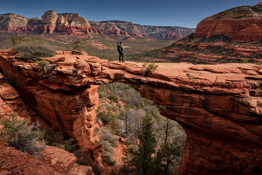
The three formations everyone asks about deserve a closer look, because each one has a trick to it — a parking rule, a timing rule, or a scrambling section — that the ranked lists skip over. Here is the practical version, place by place.
Cathedral Rock: the scramble and the shuttle
The Cathedral Rock trail is only about 1.2 miles round trip, but it climbs roughly 750 feet, and the upper half is a scramble over smooth, sloping rock with no handrails. In dry weather it is manageable for a fit walker with good shoes; in wet weather it is slippery and best avoided. The trailhead lot on Back O’ Beyond Road is small, and on Thursday through Sunday it is closed to private vehicles while the shuttle runs — Route 15 from the North SR-179 Park & Ride, first departure 7:00 a.m., is the way in, and the last trailhead pickup is around 5:12 p.m. On Monday through Wednesday the lot is open to cars, and an early weekday start is the quietest way to do this hike. At the top, the saddle between the spires is wide and flat enough to sit and take in the view down Oak Creek Canyon. Allow 90 minutes to two and a half hours, carry water, and wear shoes with grip — trainers are fine, smooth-soled shoes are not.
Devil’s Bridge: the queue and the trailheads
Devil’s Bridge has two access points, and choosing the right one saves an hour. The Mescal trailhead is the shorter route, about 3.8 miles round trip with roughly 370 feet of elevation gain, and it is served by the Route 11 shuttle from the West SR-89A Park & Ride on shuttle days. The Dry Creek Vista trailhead is longer, closer to 5.8 miles round trip, and follows a rough dirt road part of the way — it is the route people end up on when they drive, because the road to the closer trailhead needs high clearance. The last section of both routes is a steep scramble up rock steps to the arch, and at the top there is usually a queue to walk out onto the span. The arch is wide and flat, but there are sheer drops on both sides, so walk out calmly, stay behind the queue, and keep children close. The best time is the first hour after sunrise: the light is good, the queue is short, and the temperature is still kind. The worst time is midday on a Saturday in spring, when the queue can run to half an hour or more.
Bell Rock: the easy one, done properly
Bell Rock is the formation most people underestimate, because it looks easy from the road — and it is easy, which is the point. The Bell Rock Pathway runs along its base, and you can walk out for twenty minutes and turn back with a satisfying hike behind you, or continue onto the Courthouse Butte Loop for a four-mile circuit. The rock itself can be climbed partway by a faint, steep route, but there is no marked trail to the top and no need to attempt it: the views from the base trail are the ones that matter. Bell Rock is also a vortex site, and at sunset the base of the formation draws a quiet crowd of people sitting and watching the light change. Parking is at the Bell Rock Vista lot on Route 179, a designated fee site, so display a Red Rock Pass or an America the Beautiful pass. If you only have time for one easy thing in Sedona, make it Bell Rock at sunset.
Chapel of the Holy Cross and the Viewpoints That Cost Nothing
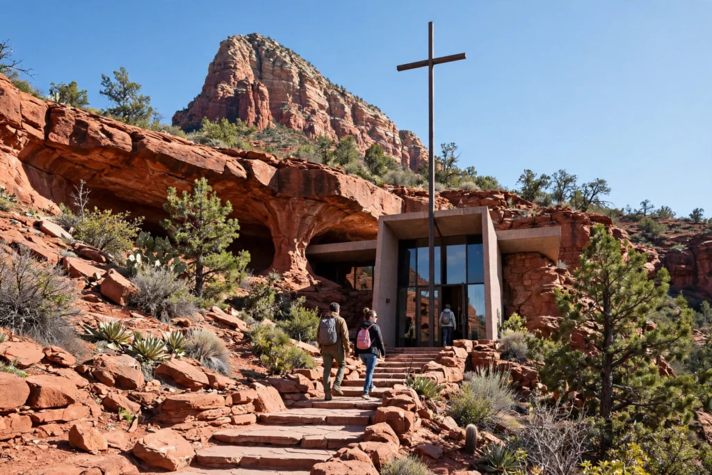
Not everything in Sedona requires a hike or a fee. Some of the best views in town cost nothing at all, and the Chapel of the Holy Cross is the most remarkable of them — a small, working chapel built into the red rock itself, and one of the most photographed buildings in Arizona.
The Chapel of the Holy Cross
The Chapel of the Holy Cross sits on a red rock butte south of town, a modernist chapel of concrete and glass completed in 1956 and built directly into the rock face, with a 90-foot cross as its front wall. It is a Roman Catholic chapel, open to visitors of all faiths, and it is free to enter. The view from the chapel terrace takes in the whole valley, and it is especially good in the late afternoon. The practical notes: the drive up Chapel Road is steep and narrow, the small parking lot fills quickly, and the walk from the lower lot to the chapel is uphill. A city shuttle service has added stops in the Chapel neighbourhood, which helps on busy days. Go early in the morning for quiet, or late in the afternoon for the light — and remember that it is a place of worship, so keep voices low inside.
Free viewpoints worth your time
Airport Mesa is covered above, and it is free to walk to the viewpoint — only the parking lot needs a pass. Red Rock Crossing and Crescent Moon Ranch give you the classic photograph of Cathedral Rock reflected in Oak Creek, and while the ranch is a concessionaire site with its own day-use fee, the view is worth it for photographers. The Chapel of the Holy Cross terrace costs nothing. The viewpoints on Route 179 — Bell Rock Vista, Courthouse Vista, and the Cathedral Rock viewpoint — are pullouts with sweeping views, and a stop of 15 minutes or less needs no pass at all. The Sedona Heritage Museum in Jordan Historical Park is a small, inexpensive stop that explains how the town grew from a farming settlement into an arts town, and it is a good rainy-day or hot-afternoon option.
Tlaquepaque Arts & Shopping Village
Tlaquepaque, at the south end of Uptown, is a Spanish-style village of courtyards, fountains, galleries, and restaurants, built in the 1970s and modelled on a Mexican village. It is free to wander, and it is the best place in Sedona to browse art without committing to a hike: galleries, sculpture gardens, jewellery, and a chapel courtyard that is quiet even when Uptown is busy. It is also a good lunch stop and a good late-afternoon stop, when the courtyards are in shade. If you are buying art, the galleries here are established and reputable, but there is no obligation to buy anything — wandering is the point.
Slide Rock State Park and Oak Creek Canyon
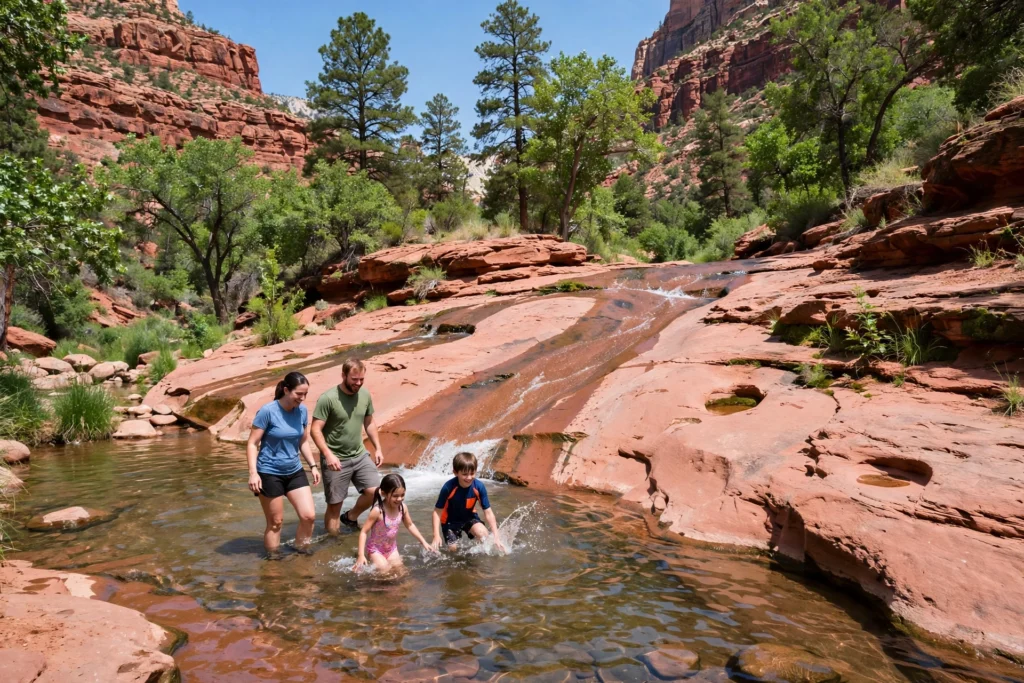
Slide Rock State Park is the most fun half-day in Sedona, and the one with the strictest rules. It is a natural waterslide: a stretch of Oak Creek where the water runs over smooth red sandstone, and you can slide, wade, and swim in pools that the creek has carved over centuries. It is also a working piece of Arizona history — a former apple orchard, with the old homestead and apple-packing shed still standing in the park.
How Slide Rock actually works
Entry is by vehicle only, through the entry station. No walk-ins, no drop-offs, and no bicycles are admitted, and there are no reservations. The fee is $30 per vehicle (one to four people) from May through September, and $20 per vehicle from October through April, with $5 for each additional adult and children under six free. Card payment is strongly preferred. The park’s hours are 8 a.m. to 6 p.m. from late January to late November, with the swim area closing at 5 p.m., and 9 a.m. to 5 p.m. in the deep winter, with the swim area closing at 4 p.m. The lot holds a limited number of vehicles, and when it is full the gate closes — on summer weekends, that often happens by 9 a.m., and there is no waiting list. The strategy is simple: arrive at opening time, or come on a weekday, or come in the shoulder seasons, when the water is cooler but the park is quieter.
What to bring, and what to know
Bring water shoes or old trainers with grip — the rock is slippery, and bare feet are a bad idea. Bring a towel, sunscreen, drinking water, and a change of clothes, because you will get wet. The water is cold even in summer, which is exactly why it feels so good on a hot day. Children need close supervision: the current is stronger than it looks, and the slide is not a playground ride. There are picnic areas, restrooms, and shade, but no food for sale inside the park, so bring snacks. And check the park’s status before you drive up: after flooding on November 1, 2026, the park closed and was scheduled to reopen on November 7, 2026, and State Route 89A north of the park toward Flagstaff stayed closed, so the approach is from the Sedona side only until further notice — see Arizona State Parks’ Slide Rock page for the latest status.
Oak Creek Canyon beyond Slide Rock
The canyon itself is worth a slow drive. Route 89A climbs from Sedona through the canyon to the Oak Creek Canyon Vista at the top, a viewpoint with Native American jewellery vendors and a view back down the canyon. West Fork, the shady canyon hike, starts from a parking area in the canyon itself. The canyon is at its best in October, when the maples and sycamores turn gold, and in spring, when the creek runs high. In winter the canyon can be icy, and the road can close after storms — check conditions with the Arizona Department of Transportation before driving it in cold weather. If you are driving on to Flagstaff, the canyon road is the scenic route; Interstate 17 is the faster one.
Vortex Sites in Sedona: What People Actually Experience
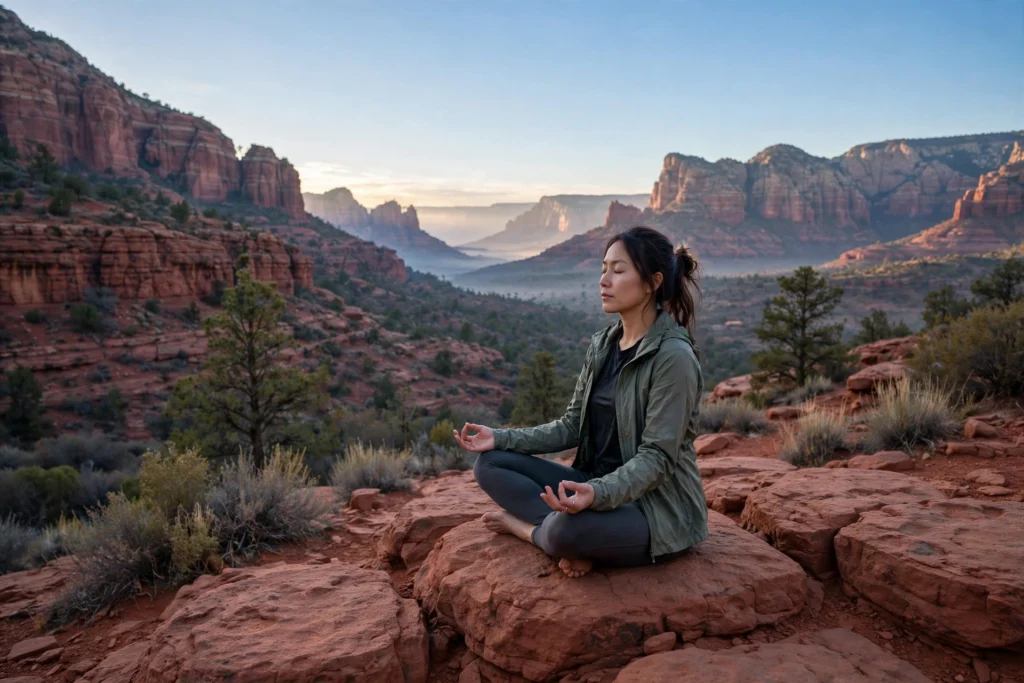
No guide to Sedona is complete without the vortex sites, and no honest guide presents them as settled fact. A vortex, in the way people in Sedona use the word, is a place where the earth’s energy is said to be especially strong — a spot where some visitors report feeling tingling, warmth, a sense of calm, or a lift in mood. There is no scientific measurement that confirms this, and the United States Geological Survey has not found anything unusual about the rocks at these sites. What is true is that thousands of people come to Sedona specifically for these places, that the four main sites are also four of the most beautiful places in the area, and that many visitors describe the experience as real and meaningful to them. This section tells you where the sites are and what people say they experience, without claiming more than that.
The four main vortex sites
The four places most often named are Airport Mesa, Bell Rock, Cathedral Rock, and Boynton Canyon. Airport Mesa is said to be a masculine, upward-flowing energy, and it is the easiest to reach — a short walk from the parking lot. Bell Rock is also described as masculine and energising, and its base trail is where you will see people sitting quietly with their eyes closed. Cathedral Rock is described as feminine, a place of compassion and calm, and its saddle at the top is where people sit for long stretches doing nothing at all. Boynton Canyon is described as a balance of the two, and it is the quietest of the four, which is part of its appeal. Each site is worth visiting on its own merits as a viewpoint or a hike, whether or not you feel anything unusual.
How to visit a vortex site
There is no ticket, no tour required, and no right way to do it. The usual approach is simple: go to the site, find a quiet spot, sit for a while, and pay attention to how you feel. Some people meditate, some journal, some just sit and look at the view. If you want a guided experience, Sedona has many local guides who offer vortex tours, and a guided tour is a reasonable choice if you want context and company — choose a small-group tour with a local guide rather than a large bus tour, and be wary of anyone who promises healing, guarantees a result, or charges a large fee for a short walk. The sites are on public land, so you can visit them all for free, apart from the usual parking pass where one applies.
What to make of it
The fair way to think about the vortex sites is that they are a belief and an experience, not a verified fact — and that the experience is real to the people who have it. The red rock country is a powerful landscape, and sitting quietly in a beautiful place has a well-understood effect on mood and attention, whether or not any special energy is involved. If you go with an open mind and no expectations, you will at worst have visited four beautiful places. If you go expecting a life-changing event, you may be disappointed. Go for the views, stay for the quiet, and let the rest be what it is.
Sedona With Kids: What Works and What Does Not
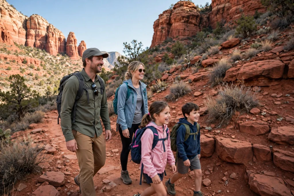
Sedona works well with children, but it works best when the plan matches the age of the children. The town is safe, the trails are short, and the red rock is the kind of landscape children actually enjoy — it looks like a playground. The mistakes are predictable: too much hiking, too much sun, and too much driving between viewpoints. Keep days short, keep water and snacks close, and build in a swim or a jeep tour as a reward.
What works by age
Under five: keep it to viewpoints and short walks. Bell Rock Pathway, the Chapel of the Holy Cross terrace, Tlaquepaque’s courtyards, and the scenic drive are all good. Slide Rock works for toddlers in the shallow pools, with close supervision and water shoes. Avoid Cathedral Rock and Devil’s Bridge — the scrambling sections are not safe for small children.
Ages five to ten: this is the sweet spot. Bell Rock, the Airport Loop, and the lower part of Boynton Canyon are all manageable. Slide Rock is the highlight of the trip for this age group. A Pink Jeep Tour — the open-air jeep rides over red rock trails — is the single best splurge for children this age, and it is worth booking in advance, because the popular tours sell out in spring and autumn.
Ages eleven and up: older children can do Cathedral Rock and Devil’s Bridge, with supervision and good shoes, and they will remember the arch photograph for years. Bear Mountain is too much for most teenagers, but Doe Mountain is a good challenge. Stargazing works well with this age group, because the dark skies are genuinely impressive and the late night feels like an adventure.
The family logistics
Start hikes early, before the heat and the crowds, and finish by late morning. Carry a litre of water per person, plus snacks, hats, and sunscreen. Use the shuttle on Thursday through Sunday — children generally enjoy the bus ride, and it removes the parking stress. Book jeep tours and Slide Rock visits for weekdays where possible. And build in downtime: a hotel pool in the afternoon, an early dinner in Uptown, and an early night will do more for the trip than a third hike. For more on travelling with children in general, the guide to the best places to travel with a baby on this site covers the youngest travellers, and the places to travel with kids guide has wider ideas for family trips.
A Romantic Sedona Trip: Sunsets, Spas and Quiet Corners
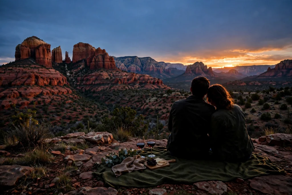
Sedona is one of the most romantic places in the American Southwest, and it does not take much effort to see why: the red rock turns gold and then purple at sunset, the restaurants are good, the spas are serious, and the night sky is dark enough to see the Milky Way. A romantic trip to Sedona is mostly a matter of slowing down — fewer hikes, better timing, and a base that feels like a retreat rather than a motel.
The sunset plan
Sunset is the centrepiece. Airport Mesa is the classic sunset spot, and it is busy for a reason — arrive 45 minutes early, bring a blanket, and stay for the half hour after the sun goes down, when the colour is at its best. Bell Rock at sunset is quieter and just as good, and the Cathedral Rock viewpoint on Route 179 gives you the formation itself in the last light. The rule for all three is the same: arrive early, stay late, and do not try to drive anywhere in the fifteen minutes after sunset, when everyone else is leaving at once.
Spas, food, and quiet corners
Sedona’s spas are a real part of the trip, not an afterthought — many of the resorts have full spa facilities with desert-inspired treatments, and a massage after a morning hike is one of the best uses of an afternoon in town. Book spa treatments in advance in spring and autumn, when the resorts are busiest. For food, Uptown has the highest concentration of restaurants, from casual cafes to fine dining with red rock views, and the Village of Oak Creek has quieter options. Tlaquepaque is a good lunch spot, and the Verde Valley, twenty minutes south, has wineries with tasting rooms that make a relaxed afternoon — designate a driver or book a wine tour rather than driving between tastings.
The quiet corners
The romantic side of Sedona is in the places that are not on the ranked lists. Boynton Canyon in the early morning, before the day’s hikers arrive. The Red Rock Crossing viewpoint at dawn, when Cathedral Rock is reflected in Oak Creek and nobody else is there. The Chapel of the Holy Cross at opening time, when the terrace is empty. And a stargazing spot on a dark road outside town, with a blanket and a thermos, which is the subject of the next section. Romance in Sedona is not about spending more — it is about being in the right place at the right time, which is mostly a matter of waking up early and staying out late.
Stargazing and Dark Skies in Sedona
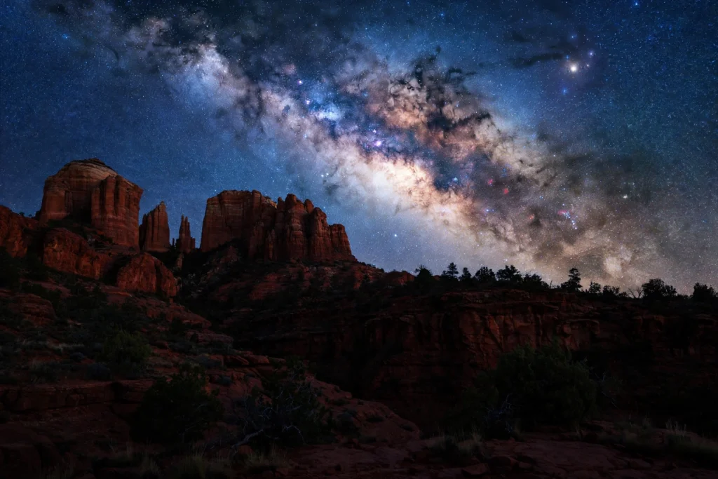
Sedona was designated the world’s eighth International Dark Sky Community in 2014, and it is one of the few places in the United States where you can see the Milky Way from near the edge of town. The town has lighting rules that keep the sky dark — Visit Sedona’s own visitor information covers the dark-sky designation and the viewing spots — the desert air is dry and clear, and on a moonless night the sky is genuinely impressive — thousands of stars, the Milky Way as a visible band, and planets bright enough to follow with the naked eye.
Where to go
You do not need to drive far. The Airport Mesa viewpoint, the Bell Rock parking area, and the pullouts on Route 179 all work after dark, and they are close to town. For a darker sky, drive a short way out of town on a quiet road — the Dry Creek Road area and the roads west of town are darker still. Avoid the nights around a full moon: the moon washes out the fainter stars, and the best nights are the week around the new moon. Check the moon phase before you travel, and plan your stargazing night for the darkest night of your trip. Summer nights are warm enough to lie out comfortably; winter nights are colder but often clearer, and the winter constellations are worth the extra layer.
How to do it well
Give your eyes twenty minutes to adapt to the dark, and avoid looking at your phone — or use a red-light setting if you must. Bring a blanket or a reclining camp chair, a warm layer even in summer, and a red torch. A basic stargazing app helps you identify constellations, but download it and its offline star data before you leave your hotel, because mobile signal is unreliable outside town. Guided stargazing tours run in Sedona and are a good choice if you want a telescope and an astronomer to point things out — book in advance in spring and autumn. And remember the practical rules: do not trespass on private land, do not block roads, and leave no trace.
What you will see
On a clear, moonless night, expect the Milky Way as a cloudy band across the sky, the constellations sharp and obvious, and the occasional meteor — Sedona’s dry air and dark sky make meteor showers, especially the Perseids in August and the Geminids in December, worth planning a trip around. The planets are visible to the naked eye when they are up, and a small pair of binoculars is enough to see the moons of Jupiter and the craters of our own moon in detail. It is the cheapest and most memorable evening in Sedona, and it costs nothing at all.
A 3-Day Sedona Itinerary
Three days is the sweet spot for a trip to Sedona: enough for the famous places, the quiet places, and a proper sunset, without rushing. This itinerary assumes you arrive the afternoon before Day 1, or early on Day 1, and that you have a car. It puts the busy hikes at the quietest times of day, uses the shuttle where it helps, and leaves room for the trip to breathe. If your trip falls on a Thursday through Sunday, take the shuttle to Cathedral Rock and Devil’s Bridge; if it falls on a Monday through Wednesday, drive to the trailheads early instead.
| Day | Morning | Afternoon | Evening |
|---|---|---|---|
| Day 1 — First impressions | Drive Route 179 in, Bell Rock Pathway walk | Chapel of the Holy Cross, Tlaquepaque, Uptown | Sunset at Airport Mesa |
| Day 2 — The big hikes | Devil’s Bridge at sunrise via Mescal trailhead | Slide Rock State Park or West Fork (cool shade) | Sunset at Bell Rock, dinner in Uptown |
| Day 3 — Canyons and sky | Cathedral Rock at sunrise, Boynton Canyon | Verde Valley wineries or Montezuma Castle | Stargazing from a dark pullout |
Day 1: First impressions
Arrive, check in, and drive Route 179 into town slowly — it is the best introduction to Sedona there is. Walk the Bell Rock Pathway for an hour, which is enough to feel the scale of the place without tiring yourself out on the first day. In the afternoon, visit the Chapel of the Holy Cross, wander Tlaquepaque’s courtyards, and have a late lunch in Uptown. In the evening, drive up to Airport Mesa for sunset, arriving 45 minutes early. Eat in Uptown, and get an early night — Day 2 starts before dawn.
Day 2: The big hikes
Start early. Be at the Mescal trailhead for Devil’s Bridge at first light, or take the first Route 11 shuttle from the West SR-89A Park & Ride if it is a shuttle day. The hike takes two to three hours, and you will be back before the heat and the queues build. Spend the hot middle of the day at Slide Rock State Park — arrive at opening time if it is a summer weekend — or, in the cooler months, hike West Fork in the shade of Oak Creek Canyon. In the evening, watch the sunset at Bell Rock, which is quieter than Airport Mesa and just as beautiful, and have dinner in Uptown.
Day 3: Canyons and sky
Start at Cathedral Rock at sunrise, taking the Route 15 shuttle from the North SR-179 Park & Ride on shuttle days, or driving to the trailhead early on a weekday. The scramble is short and the view from the saddle is the best in Sedona. Afterwards, hike Boynton Canyon, which is quieter and a good contrast to the morning’s crowds. In the afternoon, choose between the Verde Valley wineries to the south — a relaxed tasting afternoon, with a designated driver — or Montezuma Castle National Monument, a well-preserved cliff dwelling about thirty minutes south of Sedona, which is a good half-day for anyone interested in the history of the area. In the evening, drive to a dark spot outside town, spread a blanket, and watch the stars. It is the right way to end a trip to Sedona.
If you have a fourth day
Add a Grand Canyon day trip. The South Rim is about two hours north of Sedona via Flagstaff, and it is a long but entirely feasible day: leave at dawn, spend the middle of the day at the rim, and return after sunset. Note that State Route 89A north of Slide Rock toward Flagstaff was closed after the November 2026 flooding, so check the road status and use Interstate 17 via the Village of Oak Creek if the canyon road is still closed. Alternatively, spend the fourth day on a Pink Jeep Tour in the morning and a spa afternoon — the two most Sedona things you can do, and a good way to finish a trip.
Where to Stay in Sedona: Which Area Fits Your Trip
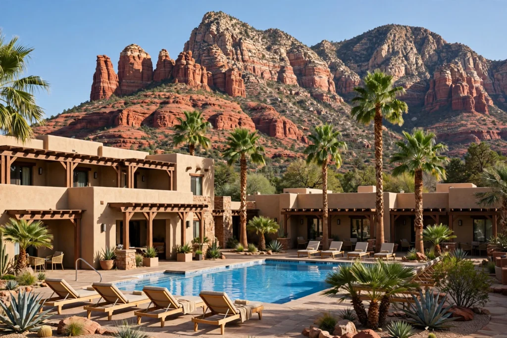
Where you stay in Sedona matters more than it does in most towns, because the town is spread out and the trailheads are in different directions. Pick the base that fits your trip, not the cheapest room, and you will save an hour of driving a day.
| Area | Best for | Trade-off | Budget note |
|---|---|---|---|
| Uptown Sedona | Walking to dinner, galleries, first-timers | Busiest, tightest parking, priciest | Highest prices, book early |
| West Sedona | Trailhead access, groceries, families | Less charming, more driving to viewpoints | Mid-range, best value |
| Village of Oak Creek | Quiet, close to Bell Rock and Cathedral Rock | Seven miles from Uptown, fewer restaurants | Mid-range, good for hikers |
| Oak Creek Canyon | Seclusion, creekside cabins, romance | Remote, winding road, few services | Varies, book well ahead |
| Verde Valley (Cottonwood) | Budget, wineries, longer stays | 20 minutes from Sedona, not in the red rocks | Lowest prices |
Uptown Sedona
Uptown is the walkable centre, and it is the right base if you want to park the car and walk to dinner. The trade-off is price and noise: Uptown is the most expensive part of town, parking is tight, and the main street is busy from mid-morning to evening. It is the best choice for a short romantic trip and for first-timers who want everything close at hand.
West Sedona and the Village of Oak Creek
West Sedona is the practical base: grocery stores, the Posse Grounds Park & Ride for the Soldier Pass shuttle, and most of the mid-range hotels. It is less pretty than Uptown, but it is where the trailheads are, and it is the best value for families and hikers. The Village of Oak Creek, seven miles south, is quieter still, with the North SR-179 Park & Ride for the Cathedral Rock shuttle on its doorstep, and it suits travellers who want a quiet base and do not mind driving to dinner.
Oak Creek Canyon and the Verde Valley
Oak Creek Canyon has a small number of creekside cabins and lodges, and they are the most romantic places to stay in the area — secluded, quiet, and right on the water. They book well ahead, especially in spring and autumn, and the winding canyon road is not for everyone. The Verde Valley, around Cottonwood, twenty minutes south, is the budget option: lower prices, wineries, and a pleasant small town, with Sedona a short drive away. It is a good base for a longer trip, or for travellers who would rather spend their money on experiences than on a room.
Booking advice
Book early for March, April, October, and holiday weekends — the best rooms go months ahead. Summer and winter are cheaper and easier, and last-minute rooms are usually available. Check the cancellation policy before you book, because Sedona’s weather can change a trip: a monsoon storm or a winter road closure is a real possibility, and a flexible booking is worth the small premium. And wherever you stay, ask the front desk about the shuttle before you plan your hikes — the staff deal with the lot closures every day, and they will tell you the current timetable.
Frequently Asked Questions About Travel to Sedona
How many days do you need in Sedona?
Three days is the sweet spot for most people: one day for the viewpoints and the chapel, one day for Devil’s Bridge and Slide Rock or West Fork, and one day for Cathedral Rock, Boynton Canyon, and stargazing. Two days is enough to see the famous places if you start early. Four or five days lets you add a Grand Canyon day trip and a Verde Valley wine afternoon.
What is the best month to travel to Sedona?
April and October are the best months for most people — comfortable hiking temperatures, clear skies, and the red rock at its most vivid. March, May, September, and November are close behind. Summer is hot and best for Slide Rock and stargazing; winter is quiet, crisp, and cheapest.
Do you need a car in Sedona?
For most trips, yes. A car is the practical way to reach Oak Creek Canyon, the Verde Valley, and the Grand Canyon. It is possible to visit without a car if you stay in town and use the free Sedona Shuttle (Thursday through Sunday) and the $2 on-demand van, but your range will be limited to the five shuttle-served trailheads and the town itself.
How much does it cost to travel to Sedona?
Sedona itself has no entrance fee. Budget for a Red Rock Pass ($5 a day, $15 a week, or $20 a year) for Forest Service trailhead parking, Slide Rock State Park ($20–$30 per vehicle), and any jeep tour or spa treatment you book. Lodging is the biggest cost and varies widely by season — spring and autumn are the most expensive, winter the cheapest. Food and fuel are moderately priced for a tourist town.
Is Sedona good for families with kids?
Yes, with the right plan. Bell Rock, Slide Rock, and a Pink Jeep Tour are the highlights for children. Keep hikes short, start early, and carry water and snacks. Avoid the scrambling sections of Cathedral Rock and Devil’s Bridge with children under about ten, and keep small children close at Devil’s Bridge, where there are sheer drops.
What is a vortex in Sedona?
A vortex is a place where, according to local belief, the earth’s energy is especially strong, and where some visitors report feeling tingling, warmth, or a sense of calm. The four main sites are Airport Mesa, Bell Rock, Cathedral Rock, and Boynton Canyon. There is no scientific evidence for the effect, and the sites are best visited as beautiful places to sit quietly, whether or not you feel anything unusual.
Can you walk across Devil’s Bridge?
Yes. Devil’s Bridge is a natural sandstone arch with a wide, flat span that you can walk out onto. There are sheer drops on both sides, so walk calmly, stay behind the queue, and keep children close. The hike from the Mescal trailhead is about 3.8 miles round trip with a steep scramble at the end.
Do you need a Red Rock Pass to hike in Sedona?
You need a pass to park at designated Coconino National Forest day-use sites — $5 a day, $15 a week, or $20 a year per vehicle — or an America the Beautiful pass ($80 a year), which works at the same sites. You do not need a pass to walk on a trail, to stop for 15 minutes or less, or to ride the free Sedona Shuttle. The pass does not cover Slide Rock State Park, Red Rock State Park, or concessionaire sites like West Fork.
When does the Sedona Shuttle run?
The free Sedona Shuttle runs Thursday through Sunday, year-round, from 7:00 a.m. to 5:30 p.m., with daily service during spring break and selected holiday periods. On shuttle days, the Cathedral Rock and Soldier Pass trailhead lots are closed to private vehicles. There is no service on Thanksgiving Day or Christmas Day. Check the current timetable on the shuttle’s own site the evening before your hike.
Is Slide Rock State Park worth it?
Yes, especially in summer, when the creek water is at its warmest and the natural waterslide is at its best. Arrive at opening time (8 a.m. in the summer season) or on a weekday, because the lot closes when it is full. Entry is by vehicle only, $30 per vehicle from May through September and $20 from October through April, and no Red Rock Pass or federal pass is accepted there.
Is Sedona safe for a first-time visitor to the desert?
Sedona is a safe, well-visited town, and the main risks are the desert itself: heat, sun, dehydration, and afternoon thunderstorms in the monsoon season. Carry water, wear sunscreen and a hat, start hikes early, and get off exposed ridges when storms build. There is no US State Department travel advisory for Sedona or anywhere else in the United States — the State Department issues advisories for foreign destinations, not for domestic travel.
What should I pack for Sedona?
Layers, in every season. A warm layer for mornings and evenings, a sun hat and sunscreen, sturdy walking shoes with grip, a refillable water bottle, and a day pack. In summer, add swimwear and water shoes for Slide Rock. In winter, add a warm jacket and check road conditions on Route 89A. In October, add a camera — the fall colour in Oak Creek Canyon is the best in Arizona.
Conclusion: Travel to Sedona With a Plan, Then Slow Down
Travel to Sedona rewards a little planning and a lot of lingering. The planning is the easy part: buy the right pass, take the free shuttle on its days, arrive at Slide Rock at opening time, and start the big hikes before the sun is high. The lingering is the point. Sit at Bell Rock at sunset and watch the colour change. Walk the West Fork in October when the canyon is gold. Lie out under a dark sky and watch the Milky Way. Sedona is a small town in a large landscape, and the best trips are the ones that leave room for the landscape to do its work. Plan the logistics, then put the plan down and look up — the red rock will take care of the rest.
People also read:
- Places to Travel in Texas: The Complete Guide to the Lone Star State
- Yellowstone Travel Guide: Geysers, Wildlife and the Best Time to Go
- Seattle Travel Guide: The Best Things to Do in the Emerald City
- Christmas Travel: The Complete 2026 Guide to Markets, Snow and Warm Escapes
- Best Places to Travel With a Baby: The Complete Guide for New Parents
- Dream Travel Destinations: The Places Worth Planning a Trip Around
- Best Time to Travel to Chile: Seasons, Weather and When to Go
- How Much to Travel to Japan: The Complete 2026 Cost Guide
- Iceland Solo Travel: The Complete Guide to Driving the Ring Road Alone
- London Travel Guide: The Best Things to Do in London

M. Adil is the founder and editor of SoloTravelPro. He writes practical, research-based travel guides that help travellers plan with confidence — from first-time city breaks to national parks and island escapes. Every guide is built on official sources, current prices and honest, usable advice, so readers can plan smarter and travel better.